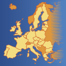
The Statistical Atlas is an interactive viewer for statistical and topographical maps. It contains all the maps from Eurostat's regional yearbook, sorted by publication themes. You can download these as high-resolution PDFs.
The Atlas covers, in detail, a wide range of statistical topics as they apply to the regions of the European Union, EFTA and candidate countries.
There are numerous functionalities and options to help you find the statistical data you are searching for and gain a better understanding of the information provided. To explore in detail all the Atlas has to offer, click the question mark button, which takes you to the Guide.
With options that range from combining various 'base maps' to accessing the statistical data used to create each map, this interactive atlas provides a novel and often surprising overview of information on the territory of the EU, EFTA and candidate countries.
The Statistical Atlas is available in EN only.
