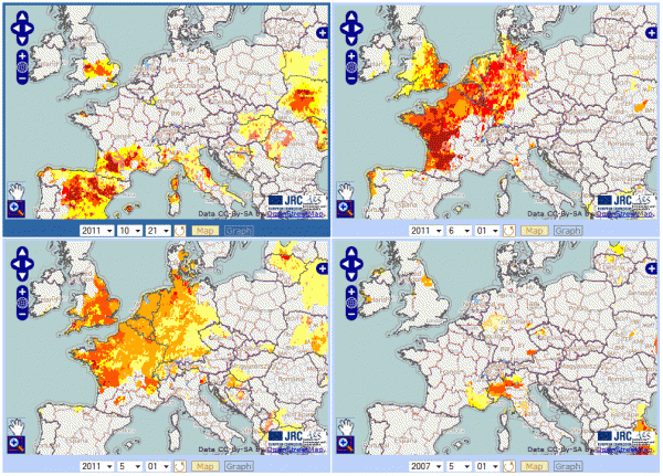
The European Drought Observatory (EDO) provides drought-relevant information such as maps and graphs of indicators derived from various data sources (e.g., precipitation measurements, satellite measurements, and distributed hydrological models). A suite of tools allows for displaying and analysing the available information and irregularly published "Drought News" give an overview of the situation in case of imminent droughts. EDO provides both complex maps for specialists as well as high-level combined indicators targeted to decision makers.
Based on EDO and similar systems for South and Central America (SCADO) and Africa (ADO) that were developed by the same team, a Global Drought Observatory (GDO) is currently under development.
For advanced GIS users the portal also gives access to OGC compliant Web Map services.