With ca. 185 000 km of coastline, Europe's seas have played a key role in shaping the economic and cultural geography of adjoining nations. Nowadays scientific knowledge about the European Seas is the basis for understanding and protecting them.
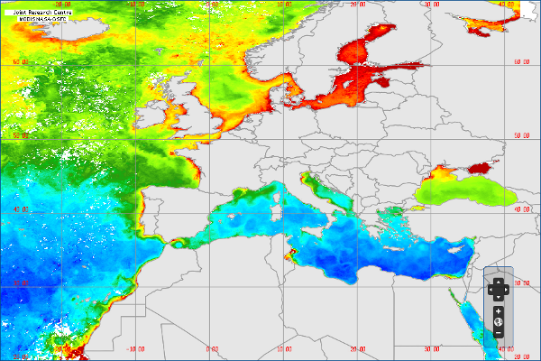
The Environmental Marine Information System (EMIS) website provides information on the inner workings of European regional seas, using biological and physical variables generated by hydrodynamic models and satellite remote sensing.
Users can easily access to spatial marine information and environmental indicators to create maps and carry out basic regional assessments.
Publication Date
Nature
Website
Charge
FREE
Data Source
EMIS (JRC)
Subject
Remote sensing
Ocean colour
Sea Surface temperature
Sea Surface Chlorophyll-a
Sea
Environment
Functionality
Data visualisation
Database
Downloadable graphics
Information analysis
Maps
Statistics
Timeline
Link to application
Language
English (en)